The Twente Trail Netherlands
The Twente Trail is a long-distance walking route through the National Landscape Park Northeast Twente, in the east of the Netherlands. This regional circular walk was created by the Wandelnet Foundation and can be walked in four days. The trail is marked yellow-red.
Total length of the walk: about 84 km (including the walk back, on the last day, to Almelo station).
The route starts and ends at Almelo train station.
Maps: the hiking guide Twente path, regional path 2, with detailed topographic maps, scale 1:25,000. With information about accommodation on the route and public transport (train, bus). Publisher: Wandelnet-LAW Amersfoort. Or buy one of the topographic maps at the VVVs.
Accommodation: see the guidebook. Hotels, B&B 's, on the farm, guesthouses, whatever you like (pay). Also possible: "Free" pole camping spots. Although we do wonder if the latter still exists. Inquire about it in advance at a local tourist office. Wild camping is not allowed.
Altitude: up to 79 m. (Paaschberg). Or the Galgenberg, near the German border: 70 m.!
Real mountains!
Marking: yellow-red, the colors of regional trails.
Genesis of landscape
The hills in northeast Twente are a result of the penultimate ice age (which began 200,000 years B.C. until about 130,000 years B.C.). The glaciers followed river valleys and deepened them considerably, creating moraines, including the North Twente moraine of Ootmarsum and that between Oldenzaal and Denekamp. Where then again later huge portions of floating ice left behind boulder clay: a combination of boulders, gravel, clay, loam, sand.......
In the last ice age, with the bracing north wind, hefty portions of cover sand, ranging from a few centimeters to meters high, came over this.
And when it thawed, meltwater formed new stream valleys again.
In the Middle Ages, a patchwork of fields and pastures emerged, bordered by hedgerows. To keep the cattle in and the predators out.
At the beginning of the 19th century, only 9% of Twente was farmland. The rest was peat, heath, marsh, wetland. But shortly thereafter things moved quickly. Population pressure, influence of the nobility, pressure on production caused major interventions in the landscape. Clearings, forest clearing, many a primeval forest that fell prey to the axe. A barer landscape emerged, in which new crops were grown.
At a time when the French provided the necessary bureaucracy: laws, distribution of land, private ownership. Not long after, 33% of the Twente land was already under cultivation.
After which the textile "fabriceurs" and their successors concentrated on planting forests and establishing estates and country houses.
With the advent of artificial fertilizer, things went really fast. Barbed wire in the prairie! Unemployed people put to work en masse to dig canals, reclaim "wasteland".....And then the land consolidation and final reclamation had yet to begin! Meandering streams were laid along the ruler. (Until not so long ago.........) The ability of the landscape to "manage" water became less and less. Floods! Or periods of severe drought. The water was "so gone."
In recent years, every effort is being made to return to "earlier times." Rivers will meander again, nature along them will be restored, old plant species stimulated, water must "stay" in the environment instead of draining away as fast as possible.....etc. etc. The Water Boards - so - continue to have work to do.
But then it turns out that the huge nitrogen emissions (farmers, traffic, car, airplane...) destroy many carefully restored nature again.
Whether then there is nothing valuable and attractive left to see?
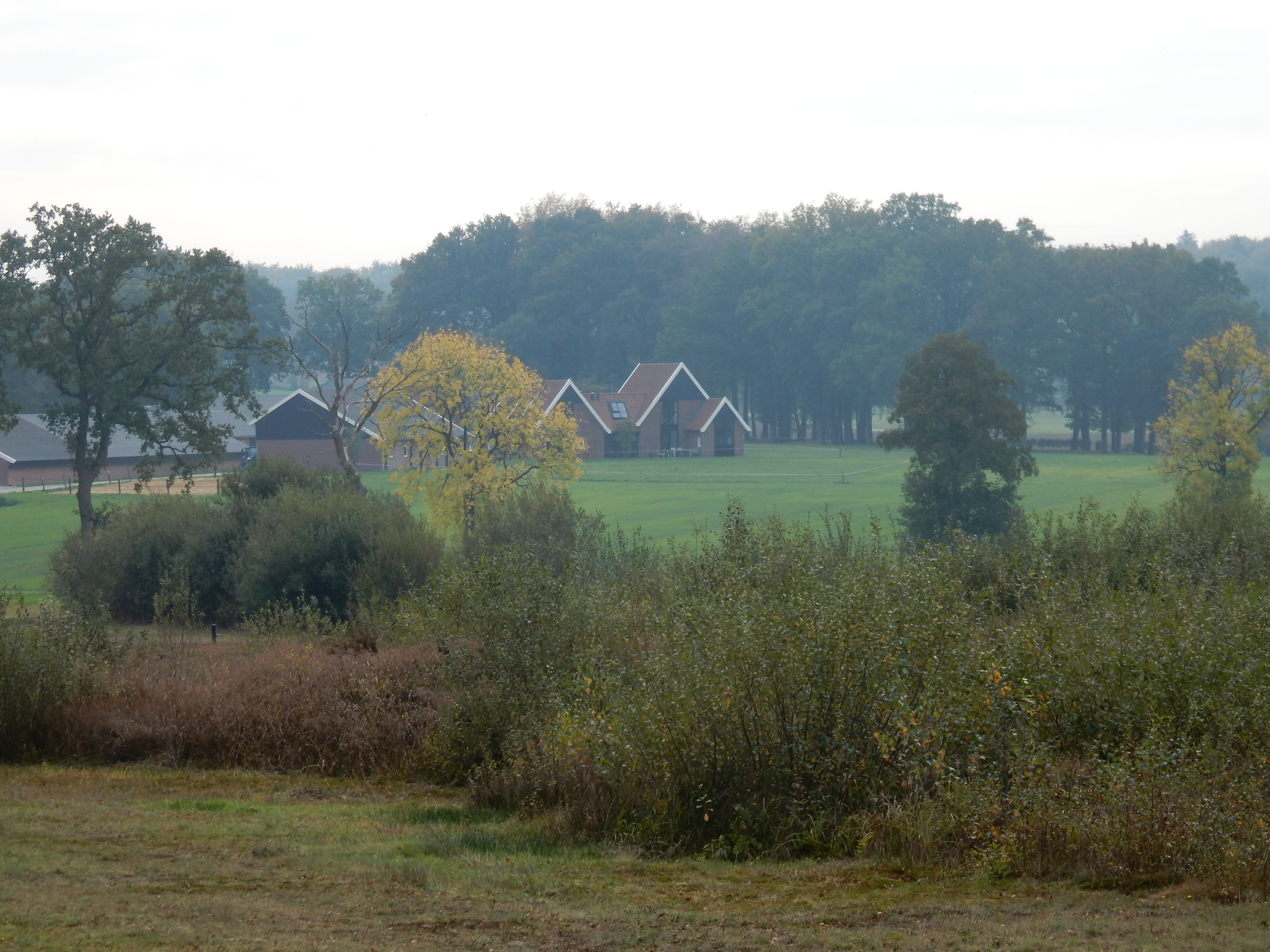
In northeast Twente, the developments mentioned above did not affect this area. But less so. The harmful effects were and are less here. As a result, an attractive, hilly and authentic area - a Landscape Park - has arisen and remained, in which it is excellent to walk.
On trail
From the Almelo train station you walk directly into the renewed city center. The Twente textile industry is now a thing of the past. At the beginning of your route in Almelo, you see the last remnant of a textile factory: the gatehouse and chimney, integrated into modern architecture. Now furnished as a restaurant. Water has recently returned to the city center.
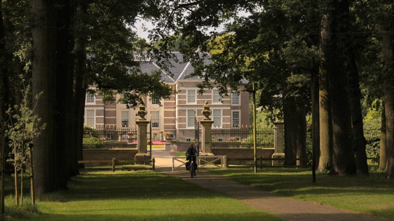
In the center of town is Huize Almelo, a castle that dates in its present form from 1662.
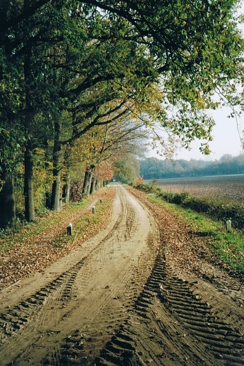
The trail follows Castle Avenue (2.5 km.), towpaths, wide and small trails, bike paths and sometimes small asphalt roads, through a landscape characterized as bocage or coulisse.
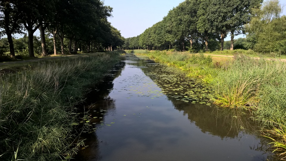
You briefly follow the Almelo-Northhorn Canal, which was dug from 1884 by unemployed people put to work and barely used by boaters. 20 years later, the canal was completely finished. And obsolete. Now a unique natural area.
Largely along the banks of the Markgraven you reach Tubbergen. Just before Tubbergen you can still see the Hondenven, a remnant from the last ice age. And if you look closely, the meters-high statue of Mgr. Dr. H.J.A.M. Schaepman, statesman, overlooking the Tubbergen ash tree. To climb via a steep staircase. With such a statesman you don't just get in touch!
After Tubbergen you slowly walk into the beautiful area around Ootmarsum. The circles of Jannink, two circular fields on the Manderheide where in the late 1920s the textile manufacturer Jannink experimented with new agricultural methods. And the "climb" of the Galgenberg is also on the program. In the Middle Ages, executions took place here. What a beautiful view! After which the beautiful Mosbeek valley is visited.
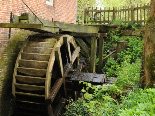
As described earlier, the soil here consists of boulder clay and cover sand, which in some places is poorly permeable, creating sources of groundwater. These springs ensured the creation and survival of the three streams, including Mosbeek. A visit to the information center IJs en Es about the history of the origins of Northeast Twente is worthwhile. Next to the visitor center are the beautiful water mills of Bels and Frans.
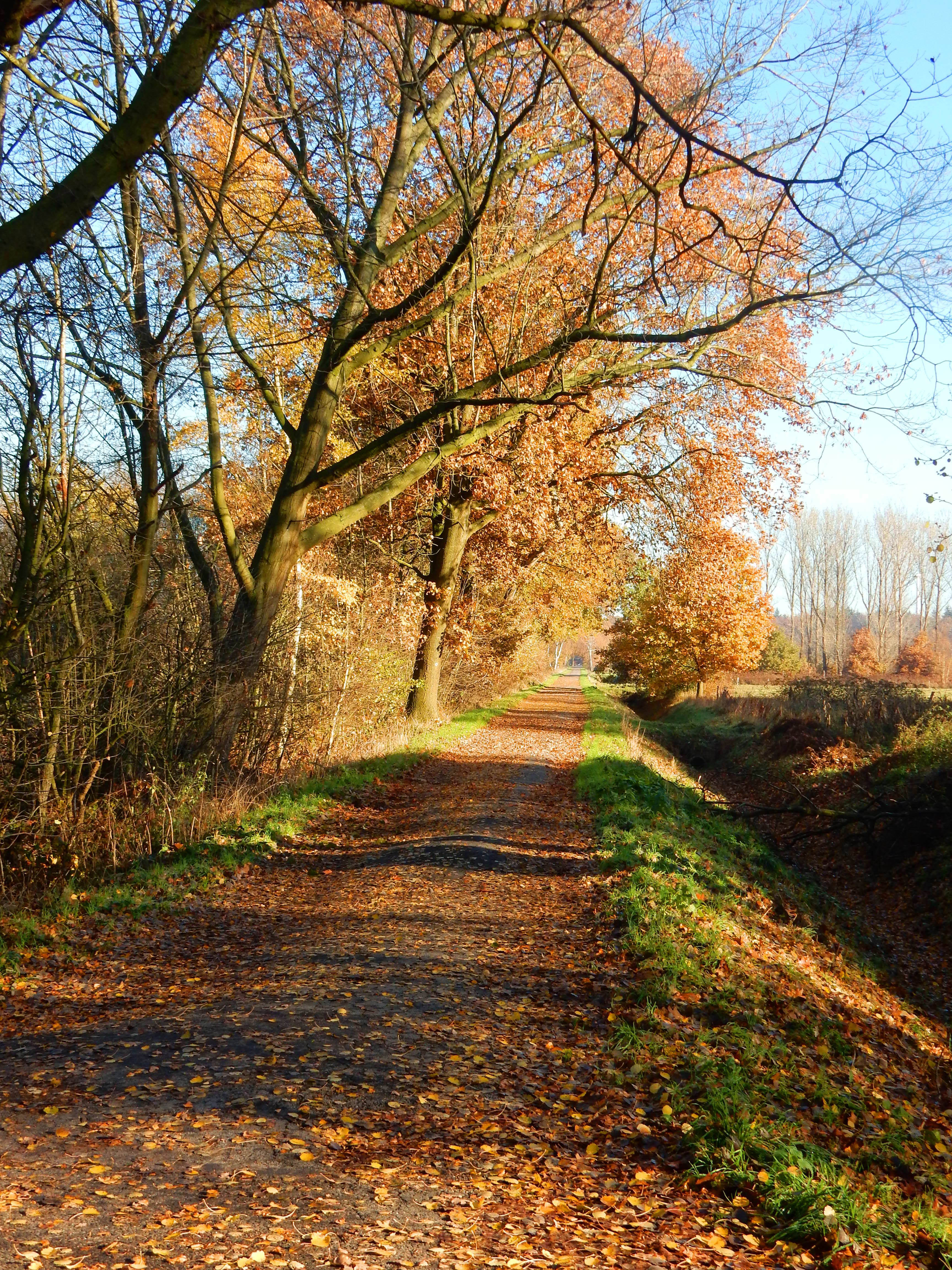
The trail continues through the Spring Valley. A lovely valley, with streams, sometimes dry, sometimes wet. The name says it all: with springs. With beautiful flowering meadows in the spring. With rare flora. An erosion valley from the last ice age.
To walk after 40 km - two days? - reach the old town of Ootmarsum.
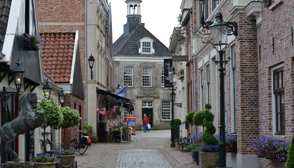
Ootmarsum successfully presents itself as a town of artists. And you have to love that art. The town still cherishes many old customs, including the "vlöggeln" at Easter. A kind of initiation ritual. Much of the inner city has been preserved and is worth visiting.
After which it goes in the direction of Oldenzaal. Partly through an area where the effects of the land consolidators are best seen. Wet pant lands and largely disappeared. Streams were laid along the ruler. A few small sections were preserved. Wooded banks met the axe. The farmer had other priorities than nature management this time.
After a stretch along the Almelo-Nordhorn Canal, the route heads toward the Singraven estate. With House Singraven, the Coach House, a watermill and a diverse landscape with woods, lanes, fields, meadows and some marshes. And, of course, the ever-present Dinkel.
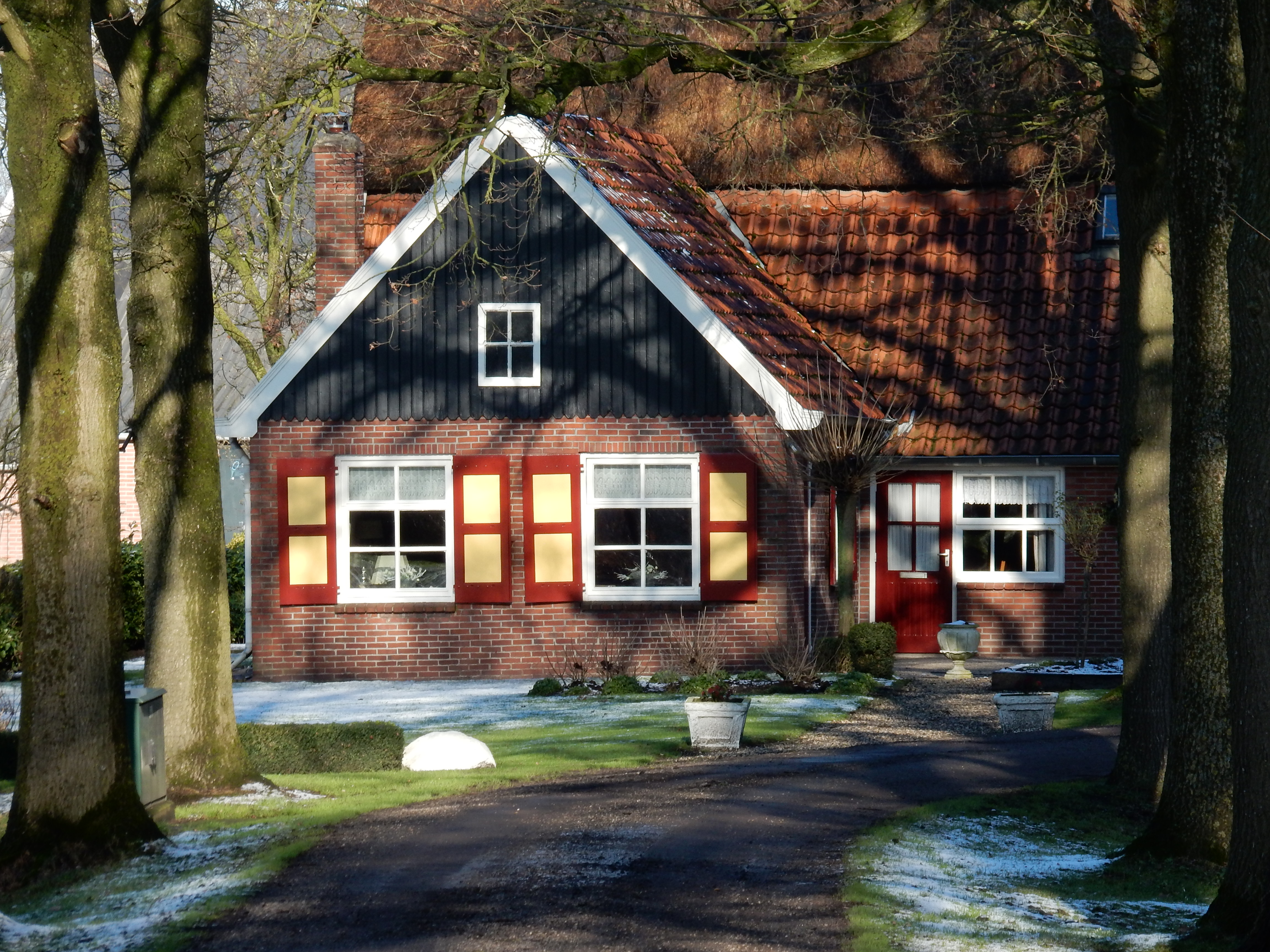
In the vicinity of Oldenzaal you come across several country houses. Built from the profits from the textile industry. The buitenplaats. Or Buitenplaets. The factory owners knew where to find the most beautiful places in the hills and built beautiful accommodations. Some of them also devoted themselves to agriculture. With model farms. To meet the demand of the growing (working-class) cities. If you control the production of basic necessities, you can also keep wages lower. Thus and often heard explanation for the "hobby" of these manufacturers.
And on through the hill country: the Tankenberg, the Paaschberg, the Hakenberg. Up to 85m high. You can't get any higher in Overijssel! A beautiful area! Where you can also encounter various other long-distance walking routes: the Noaberpad, the Fabriceurspad, the Hilligenpad, the Havezatepad. Just to name a few.
Oldenzaal is mainly characterized by the presence of the Plechelmus Basilica. Romanesque. Of sandstone. From the middle of the 12th century. Due to lack of money, a rigorous renovation did not go ahead. With which one of the few Romanesque churches in the Netherlands was preserved. As described, nature was different!
From Oldenzaal begins the last stage, back to Almelo. 30 km.
Through the recreation resort and estate Het Hulsbeek. Through the coulisse landscapes typical of Twente, along a few streams and the Molenven. A piece of rugged nature, open water willow forest and trouser forest. A remnant of what was once common.......
The mill of Saasveld and the open-air theater of Hertme. Where, among other things, the Africa Festival takes place. Once built to stage the passion plays there.
With some beautiful pieces along the Born brook. To come back again for a canoe trip?
To see, almost at the end of the hike, the beginning of the Doorbraak: a new meandering waterway between the Bornse Beek and the Regge. 13 km of new nature, too. And a fine example of how conceptions of nature management, water discharge or water retention, relatively clean water nurture, have taken hold.
You are then back on the Gravenallee, where your walk began. Make a note of how the Count of Almelo knows how to maintain his estate perfectly!
Another short distance to the NS Station Almelo.